The Coleford, Monmouth,
Usk and Pontypool Railway
(The CMUPR)
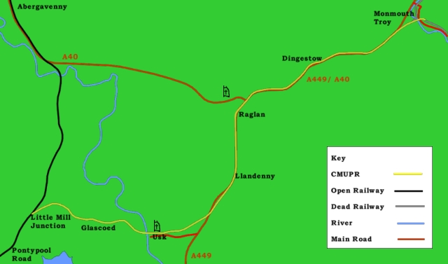
The CMUPR had the longest
history and the longest title of all the railways to Monmouth
(we apologise if the title doesn't fit on your screen). The first
stretch of its proposed route began to be used for transport
in 1810 with the opening of the Monmouth Tramroad between Coleford
and Monmouth; the trackbed between Usk and Monmouth is at the
busiest it has ever been in its new form as the A449/ A40 dual
carriageway.
The first serious plans came
very early on - in the 1840s - for a Dean Forest, Monmouth, Usk
and Pontypool Railway, which would have done an even worse job
at fitting on the screen. It was one of these lines that failed
fairly early on, although more of it was eventually built than
was usual for such railways; the largest single chunk and the
first bit to be opened was that taken on and proposed again by
the CMUPR in 1855. (The other end was built by the Forest of
Dean Central Railway with even less success and the bits in the
middle were bungled together from tramways, except for a proposed
tunnel under a hill in the middle of the Forest which was never
built at all.)
The actual railway was opened
from Pontypool to Usk in 1856 and reached Monmouth in 1857 after
a rather tricky construction featuring several financial problems
and a collapsing tunnel. None of the Monmouth railways had easy
births - three struggled financially before they even opened,
one was considerably overdue and obsolete by opening and the
fifth was stillborn - but the CMUPR should really have had it
easiest, given the largely flat or gently rolling terrain that
its route passed through between Pontypool and Monmouth. The
terminus, at Monmouth Troy, was built on the outskirts of the
town with the aim of converting it to a through station for trains
to Coleford. The decision was farsighted and showed the great
plans that the Company had for its railway.
When you see a modern road
and think that it doesn't seem to have been built for the traffic
levels that it's carrying, that's partly because the Governments
of the 1950s and 1960s learnt from the railways and didn't pour
money down holes that they could make much smaller. Monmouth
Troy became a through station, but it never obtained the importance
planned for it and its atrocious location, well away from the
centre of Monmouth, could be held partially responsible for the
loss of Monmouth's rail services in 1959. By then the CMUPR was
already dead; the last regular through train to Monmouth had
run in 1955. The Company managed to extend across the Wye to
Wyesham in 1861 (with considerable outside support); it survived
in theory to see the completion of the extension to Coleford
over the Monmouth Tramroad in 1883 four years before it was officially
absorbed into the Great Western, which had held a lease on the
line since 1863 and had run trains over it from the outset. This
somewhat delayed completion of the Company's scheme was little
more than winding branch line which, isolated from the main rail
networks in the Forest of Dean, disappeared in 1917. The CMUPR,
uniquely amongst Monmouth's railways, was built for the subsequent
provision of double line (both tunnels and most bridges were
wide enough) but the second track was never laid.
A closure proposal in 1954
was rejected and replaced with a remarkable service increase
from four trains each way each day to eleven. Six months isn't
really long enough for a new service to bed in (although the
response was still a remarkable increase in traffic), losses
continued and the line closed in the middle of a national rail
strike the following year. In 1960 the line between Usk and Monmouth
was removed and today just a stub remains at the Pontypool end
to serve a Royal Ordnance Factory. This was a rather security-conscious
starting point and the line was somewhat out of the way and insignificant,
so pictures of this stub don't seem to be exceptionally common.
A couple of photos from 1989 in The Ross, Monmouth and Pontypool
Road Line show a train that is so anonymous (unnamed blue
Class 47 diesel loco, unbranded Speedlink van, rake of 1950s
four-wheeled vans, equally anonymous 1980s four-wheeled van)
that it is suspiciously so and obviously carrying something which
is trying too hard not to be noticed.
Monmouth's first railway is
also its last; like the Wye Valley line, nowadays the Coleford,
Monmouth, Usk and Pontypool Railway's stub is derelict and overgrown.
It lasted to the age of 137 and the mainline connection - uniquely
for the four - remains in place.
The presence of the dual carriageway
on much of the route is in many respects a compliment - the railway
has been approved for use into the 21st century and passed for
70mph running. Sadly it is no longer a railway however, and reopening
throughout is unlikely. Usk could be reunited with the rail network
for the cost of 1½ miles of track - all but one of the
bridges along the route are still in place, the station platforms
at Usk are intact and the site is vacant. The junction is fully
signalled (unlike that at Wye Valley Junction, which was set
up as a siding). A link to Monmouth would involve realigning
bits of the dual carriageway (particularly between Usk and Llandenny)
and modifying a couple of junctions, which would allow the railway
to run along the western side of the road through Raglan and
Dingestow stations. At Monmouth a new tunnel could be bored to
carry the railway to a new Riverside station just yards from
the town centre or the road could be extensively rebuilt to allow
the railway to pass under it and head into Troy station. Alternatively
the line could be allowed to pass under the new road at the former
Cefn Tilla Halt and run up the east side of the road, free to
swing away on the approach to Monmouth Tunnel and somehow working
around the sliproads on the road junction at Raglan. Unfortunately
all these options would cost huge sums of money and for that
reason it will never happen.
Meanwhile Troy's main station
building survives at Winchcombe station on the Gloucestershire
and Warwickshire Railway, Dingestow station is a private residence
and Raglan is part of a road maintenance depot. There are proposals
to move Raglan station building to the Museum of Welsh Life at
St Fagans - the Museum has a large gap in its collection, with
a complete absence of mass-transport related artifacts to cover
the contribution that railways and canals made to Welsh life.
The entire line between Monmouth and Pontypool is currently regarded
as being in Wales and a complete plan of the railway can be found
in the National Library of Wales at Aberystwyth, although the
rolling landscape is hardly typical of the Principality. Unfortunately
the six fine pine trees which used to stand over the Raglan station
cannot go with it - five were felled to make way for the A449,
although the survivor will probably survive the removal of the
building. The only remaining building along the entire line will
then be the station building at Dingestow.
Despite through trains between
Ross and Pontypool ceasing after the two lines came under one
owner in 1923, the route is still counted as one line for the
purposes of maintaining the few surviving structures and is accordingly
catalogued as "ROS". Mileages are counted from Ross
on Wye. What the management of the senior railway would think
of this is unrecorded.
|
Pontypool Road
|
Pontypool Road opened in 1854;
it was then a fairly insignificant station on the Newport, Abergavenny
and Hereford Railway. The following year it became a junction
when Pontypool got a decent station in the town centre with the
opening of the Taff Vale Extension line to Crumlin Junction in
the Ebbw Valley a few miles to the west. The year after that
it became the junction for Usk via the railway that is the subject
of this article. That was extended to Monmouth the next year.
Within another year the Taff Vale Extension had been extended
to the Taff Vale and made a junction with the Taff Vale Railway
at Quakers Yard. (The neighbouring Rhymney Railway had been planning
to use this extension too, but it took so long to be completed
that they got bored and built another line.)
Two lines to nearby Blaenavon
followed. The lower line was run by the Great Western Railway
and terminated at Blaenavon Low Level. The upper line was run
by the London and North Western Railway and ran through Blaenavon
High Level, over the highest point on the standard gauge rail
network in England and Wales at Waenavon and down the mountainside
to join the Newport, Abergavenny and Hereford just south of Abergavenny
station. The Pontypool, Caerleon and Newport Railway opened in
1874 and provided a second connection from here to the docks
at Newport.
Pontypool Road thus got to
be a major junction. It was rebuilt in 1908 to feature one great
island platform with bays at each end (the south one serving
various branches and the north one exclusively for Monmouth trains).
Signals arrayed themselves impressively around the station area.
A massive loco shed, rakes of carriage sidings and masses of
marshalling yards around the station and the triangular junction
to the south of the station to the south completed the scene.
The two lines to Newport began
to be rationalised in the 19th century before the network had
quite reached its peak. Passenger services through Blaenavon
High Level were suspended "for the duration" (of the
Second World War) in 1941 and never resumed. The north bay lost
all traffic in 1955 when Monmouth services ceased. Then in 1962
Blaenavon Low Level closed, along with the older line to Newport.
The Taff Vale Extension went in 1964; a collapsing viaduct beyond
Quaker's Yard (opened in 1864) probably helped the case for the
closure of the only one of Pontypool's branches to be condemned
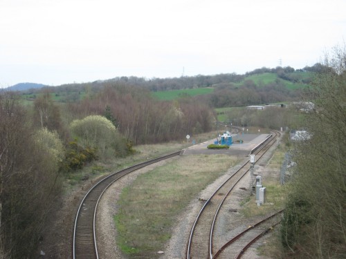
by Beeching. The station was cut back - literally. Apart from
the loss of the bay platforms, buildings, canopy and most of
its services, the core platform was also sliced back at each
end. Its former extent is particularly obvious in the upper picture;
much of the area of grass between the two main running lines
used to be platform.
The remaining colliery traffic
from the London and North Western route ceased shortly after
the Miners' Strike in the 1980s. All claims to junction status
were finally swept away when the first branch to be completed
became the last to completely go in 1993. Only one signal remains
in the entire station site - signal LM104, visible with its back
to the camera in the upper picture. It is controlled by the signal
box at Little Mill. It is a very stark contrast to "Pontypool
Roads" "out on the mainline" featured in Ivor
the Engine - although Ivor himself can still be seen occasionally
on the Pontypool and Blaenavon Railway, which has preserved a
particularly steeply-graded section of track heading north for
a couple of miles from Blaenavon High Level.
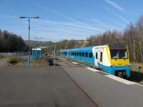
The lower picture shows one
of the Class 175 "Coriada" units which now operate
services over the Newport, Abergavenny and Hereford and provide
Pontypool and New Inn, as the station is now known, with one
train in each direction every two hours. Northbound trains tend
to head either to Manchester or to Holyhead; southbound ones
variously terminate at Cardiff Central, Carmarthen or Milford
Haven.
Trains for the Monmouth branch
would head north from their bay platform - there were no regular
passenger trains from starting points beyond Pontypool Road and
branch passengers would have to book another ticket at the junction
if they wanted to go further afield - and run up the mainline
for about a mile to the junction at Little Mill. Unlike Pontypool
Road, Little Mill has lost little of its old importance - partly
because it never had any importance. |
|
East of Little Mill Junction
|
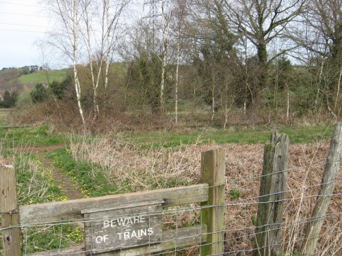
Little Mill Junction does
not actually feature in this picture. It is one of those annoying
junctions which isn't near any handy overbridges, passed by a
footpath or sat by a station, so you have to either engage in
a spot of trespassing or take pictures out of train windows.
The former is a trifle dangerous and results in images which
we can't show you; the latter is a bit expensive for the quality
of the image which can be obtained but will have to be used for
Little Mill at a suitable moment.
The junction had a junction
station, but it was really only for branch trains. The result
was a reasonable service for the little village connecting them
to Pontypool and Usk from a little wayside platform with a decent
building. It was the most impressive of the four junctions at
the non-Monmouth end of the Monmouth branchlines, with a set
of sidings and a tidy array of signals.
After the line closed to passenger
trains the station was demolished, but the access road remains
with no warning at the outer end that it leads exclusively to
railway property (although it is tidily padlocked occasionally).
Little Mill signal box remains and the junction has survived
intact, complete with signalling and a modern 10mph speed restriction
board. Trains can no longer run to Glascoed whenever they
like, however, since some cad has put a bufferstop across the
line a chain or so from the 15mph speed limit board which allows
trains to accelerate to that daredevil speed for their journey
along Monmouth's last railway.
Branch Lines to Monmouth cites the 31st of January 1993 as
the last freight train over the branch. The track is now overgrown.
The ominous warning sign, seen here at a foot crossing on the
south-western outskirts of Little Mill, seems a little amusing
upon looking up and seeing the rails behind. A board at a crossing
further up demands that you "Stop, Look, Listen" on
a line clearly not used in many years when you want to use an
equally derelict track over the railway. |
|
Glascoed
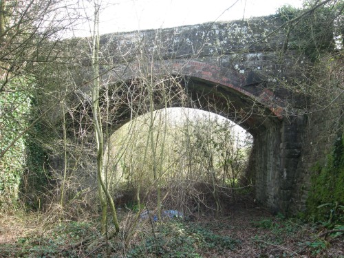
|
Glascoed is a very small and
quiet village a mile from the railway, but nonetheless once boasted
three stations. However, only one of these - sited on the other
side of this bridge - was intended to serve the local population;
the other two were provided for the benefit of the workers at
the nearby Glascoed Royal Ordnance Factory. They were a little
further up the line - the diminuitive Glascoed Factory West Access
Halt was quarter of a mile up the line, while Glascoed Factory
East Access Halt was three quarters of a mile beyond that.
Glascoed Halt, located just
to the east of a fine stone overbridge with a brick arch, was
a little timber trestle platform with a standard GWR "pagoda"
shelter which opened in 1927. It was on the right-hand side of
the single running line which passed under the left-hand side
of the bridge. When a loop was laid for the factory it was moved
to the left-hand side of the running line - such are the benefits
of kit-built stations. Books on the line all agree that it was
27¾ miles from Ross on Wye. This is unfortunate, because
this is the only bridge in the area which qualifies but the milepost
on the other side proclaims that it is 27½ miles from
Ross on Wye. It is, of course, quite possible that when the new
milepost was being made up (it is a modern metal milepost rather
than an old wooden one) someone forgot how to count to three.
Equally, the books could be wrong. The bridge is rather unobliging
and does not carry an engineer's code announcing how far from
Ross it is. Since the matter is of little importance we won't
bother to cast a vote on it.
The entire CMUPR was originally
set out for double track but only a single line was laid. Like
most other railways in the country which were set up this way
the railway remained single track for its entire career. However,
it did have the benefit that a loop line for the Royal Ordnance
Factory could be provided without having to widen the bridge.
Glascoed thus became one of the very few halts in the country
with full signalling and a signal box. The three halts all closed
when the passenger service was axed and the signal box went with
the section from here to Usk. However, unlike the Wye Valley
line, the bridges all seem to be in reasonable condition. |
|
Usk and Usk Tunnel
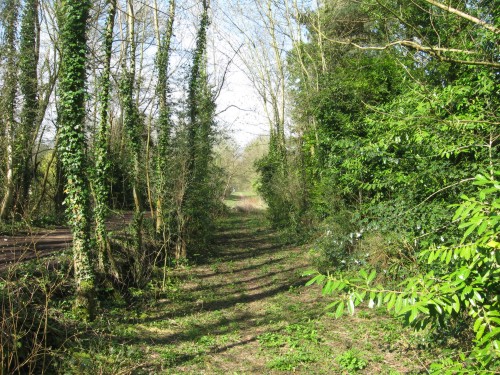
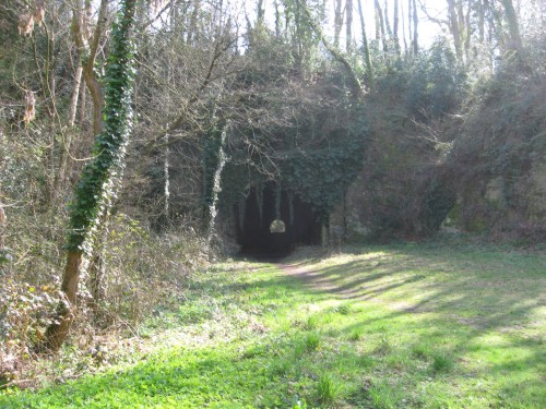
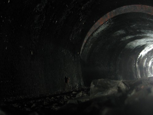
|
Usk station was the initial
terminus of the line, opening on the 2nd of June 1856 pending
the completion of the line to Monmouth. It and Monmouth Troy
would ultimately both be laid out in a very similar manner, with
a double track line running into a tunnel (inside which the double
line reduced to single), the goods yard and main buildings both
to the right of the tunnel and a river crossing at the opposite
end of the station to the tunnel. The fact that both had many
detailed differences - for example, the bridge here was over
the Usk and carried double track while at Monmouth there were
two single track bridges over the Wye - merely shows what variations
can be made to an unoriginal theme.
The extension to Monmouth
met many little difficulties, the principal of which was the
tunnel at the east end of Usk station (west portal in the middle
picture, inside in the bottom picture). It notably fell in during
proceedings, resuling in some rather interesting internal profile
variations. (Other tunnels on the Monmouth rail network have
little oddities - Lydbrook, on the Ross and Monmouth, has two
styles of lining, while Tidenham, on the Wye Valley line, has
lengthy unlined sections - but none of the other nine have mis-matching
portals and wobbles in the lining.) However, the line was successfully
completed and subsequently opened on the 12th October 1857.
The station was lightly described
by one J. H. Clarke in 1891 as a "miserable little hut"
which had been opened with the line and seen minimal improvement
since. Progress was made and in 1897 a new set of facilities
were completed to provide passengers with greater comfort. Edwardian
views of the station show a very tidy site with handsome structures,
a covered footbridge to link the two platforms and the station
name written in creepers trained to climb appropriately up the
cliff to the left of the tunnel portal.
Decline then duly set in.
The station's resemblance to its younger sibling at Monmouth
began to vanish with the loss of the footbridge in the Second
World War. Trees grew up and hid the rockface, though a drop
in staffing levels meant that there was less time to train the
creepers anyway. Business slackened slightly in the inter-war
years. All passenger trains and through goods services to Monmouth
ceased on the 28th of May 1955 when driver's union ASLEF held
a national strike; formal closure came on the 13th of June, the
day before the strike was settled and services on all other lines
in the country were able to resume (not quite as normal, however
- the pay rise demanded was obtained at the expense of the long-term
future of the network when the country used the two-week cessation
of services to realise that it could largely manage quite happily
without railways).
The line to Monmouth was then
used for wagon storage - a fate to which several abandoned lines
succumbed while British Railways worked out how many wagons they
had actually inherited at Nationalisation. (They had also inherited
the official documentation on how many wagons they should have
inherited, but said documentation turned out to be slightly less
reliable than tea leaves.) On the 12th of October 1957 a final
passenger train celebrated the line's 100th birthday by running
to Monmouth and back. The track through the main platform (left
in the top picture, right in the middle) was lifted in 1959 and
swiftly followed by the line from here to Monmouth. The remains
of the station closed on the 13th of September 1965. Subsequently
the line was cut back to Glascoed; a bridge on the west bank
of the Usk over the A472 Pontypool to Usk road was removed soon
after and the continuity of the trackbed broken.
Yet 45 years on this bridge
remains the only point on the line from Little Mill to Usk where
the continuity of the trackbed has been broken. Re-instating
the bridge would now be more acceptable (it would impose a height
limit on passing lorries, but there's one of those at the Little
Mill end of the road too so it wouldn't prevent its use as a
through route). Passenger trains funding the upkeep of the line
would encourage BAe Systems to start using it again. Usk station
is largely ready for the return of trains with its still-intact
platforms (see upper picture). The double-track infrastructure
would allow a half-hourly service to and from Newport or Cardiff
with a footpath remaining over the river bridge.
Why not? |
|
East of Usk
|
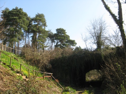
Once out of Usk Tunnel the
line ran through a cutting along the north flank of Usk before
heading out on a slight embankment into open country (railways
are very bad at deigning to run at the same level as the surrounding
land). The open country duly carried it around to Cefn Tilla
Halt, where the line picked up the Olway Brook (which was straightened
to make life easier) and followed its valley up to Raglan.
The trackbed is seriously
broken for the first time in this area. This picture looks roughly
eastwards along the line towards the end of a linear nature reserve
now developed along the old cutting. The heavily overgrown bridge
allows a suburban road to cross on a skewed route. Beyond is
a short length of cutting which has been partially infilled to
allow a new suburban road to be run across the line. After that
the trackbed disappears into the general landscape for a bit,
although it doesn't appear to have been seriously built over.
Should the line be reopened
to Usk it would be worth giving serious consideration to making
this the eastern terminus, rather than Usk station. It would
serve a few hundred additional people and allow a Park and Ride
station conveniently situated for the A449, which has a junction
about a mile away. The trees to the left would make it feel like
a real Great Western station. On the downside, half of the attractive
and secluded nature reserve would get turned into a railway and
it would become a substantially narrower green avenue. |
|
Cefn Tilla Halt
|
Cefn Tilla Halt was the last
new station to open on the Monmouth rail network. The 1954 timetable
change brought an additional 7 trains each way each day between
Pontypool and Monmouth and accompanied this by slowing services
slightly with a nice new halt at Cefn Tilla. This had the benefit
that the express locomotive named after the Court of the same
name could now stop at the local station - although the line
was not noted for the frequent visits by express locomotives
and the cab of your average Great Western express loco was larger
than the halt platform.
Cefn Tilla was the ultimate
display of low-cost service improvements (nobody asked at this
point if unremunative services were really best improved by providing
additional isolated stops however). The platform was located
in a slight cutting just north of a minor road overbridge a mile
out of Usk adjacent to an attractive stone cottage; the six-foot
long wooden structure, with the nameboard on the cutting wall
behind it, was sat on the half of the cutting set aside for the
never-laid southbound track. It did not last long enough to appear
on maps, though it is reported to have managed around ten passengers
a day (which meant that during the peak timetable it got one
passenger for every two trains). Closure came less than a year
after it opened.
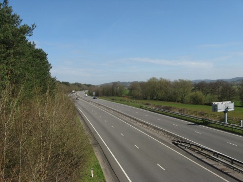
Nowadays the insignificant
halt is well up in the "Disappearing stations" rankings.
The slight embankments on each side of the cutting were swept
away after closure. Bridge, halt and house all vanished under
four lanes of tarmac with the opening of the A449 dual carriageway
between Newport and Monmouth. A slight gap in the trees in the
centre of the image marks where the railway once headed northwards
from the little halt. |
|
Llandenny
|
Llandenny station was the
smallest of the four intermediate stations on the branch; it
had no platform shelter and fairly minimal facilities. Curiously
it was also, of the three stations between Usk and Monmouth,
the closest to the village that it intended to serve, which was
only a few yards away.
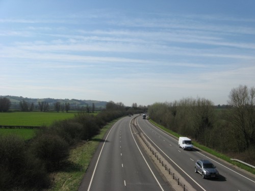
The station was split across
a level crossing, with the station buildings, platform and signal
box on the south side of the crossing (about where the van is
in this view) and the loop and cattle dock on the north side.
A couple of sidings branched off to the right and lay behind
the main station building.
The only real changes over
the station's entire existence were that after closure the grass
got a bit longer, the buildings and crossing gates got a little
more dilapidated and the nameboard and seat vanished. Otherwise
it was a largely unchanging station in the shadow of some gently
growing pine trees in an attractive rural spot.
It is rather less attractive
and rural now. Llandenny is less of a place for the curious to
get off the train and nose around too. Instead, traffic swoops
past at 70mph. A "Spot the Difference" competition
between this view and pictures of the active station (though
it never was a real centre of activity) resulted in the eventual
verdict that the background hills look more or less the same.
The local road now has a bridge rather than a level crossing. |
|
Raglan Road Crossing Halt
|
The original station at Raglan
was, for some obscure reason, two miles from a village which
the railway passed within half a mile of - probably something
about the main road in the area crossing the line here, thus
saving them the bother of building a road to link the railway
and making the railhead for the area accessible to lots of people.
It is also about equidistant between Dingestow and Usk, allowing
that section of line to be broken neatly in half and thereby
maximising the capacity of the single line. The reason as to
why the inhabitants of the largest centre of population should
have to walk two miles to their station was so obvious that the
traincrew were unable to persuade the passengers of the indisputable
and entirely logical reasoning behind locating the station as
far away from any habitation as it is possible to get in this
area and took to depositing passengers at the platformless Raglan
Footpath instead. Subsequently (in a largely unprecedented and
almost never-to-be-repeated move) the railway company realised
that it had put its station in the wrong place and built a new
one at Raglan.
The original site completely
fell into disuse and was largely ignored by trains for some years,
but when the GWR decided to slow down trains on this line a bit
by adding a few extra stops re-opening the original Raglan station
was fairly high on the agenda and services to the new halt began
on the 24th of November 1930. This was a railway with a long
name, so appropriately Raglan Road Crossing Halt seemed to be
named with the intention of competing with Llanfairpwllgwyngyllgogerychwyrndrobwllllantysiliogogogoch
in the "stupidly long name stakes".
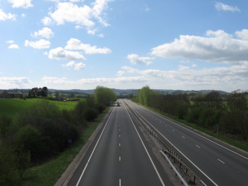
The halt, with its little
dirt-and-timber platform, did a fairly good job of serving the
local community (which can be seen to the left of the picture)
over its career. It had a small corrogated steel shelter of the
type used on the Wye Valley line. After closure it soon became
overgrown; both it and the level crossing were swept away for
the dual carriageway built on the alignment in the 1970s. |
|
Raglan
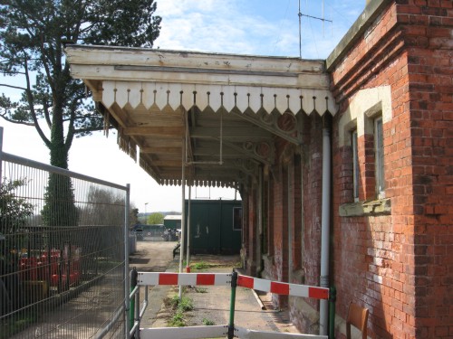
|
Raglan was the last station
on the line to open (although a few halts would come later).
Trains stopped here from very early on due to the fairly convenient
location of the point in relation to a footpath to the village
with its rather fine, if not particularly medieval, ruined castle.
After the Great Western took over the line in 1863 steps began
to be taken - rather slowly - to upgrade the route and Raglan
Footpath was relaunched as Raglan station in 1876.
Like all the other stations
on the line, goods facilities were provided at one end of the
station site (the north end on this occasion) rather than opposite
the platform. The platform instead overlooked a rather fine row
of six pine trees. On this platform was a fairly handsome, if
slightly basic, brick building with a simple awning. It was not
in character with any of the other stations along the line.
The station was still not
exactly in Raglan - the walk is not unattractive but is equally
not likely to encourage traffic. The poor location of the station
in relation to the second largest intermediate centre of population
(after Usk) won't have helped business. Nonetheless, the dead
station has done rather well in terms of simple survival. Unlike
Llandenny, the building escaped demolition to make way for the
A449 and still stands today on one side of a road maintenence
centre alongside the dual carriageway, which is out of view to
the left. One tree also remains. A prefabricated goods shed which
once stood in the goods yard is apparently now at Norchard on
the Dean Forest Railway. |
|
Elms Bridge
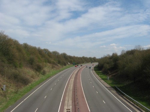
|
Elms Bridge was the last of
the three halts opened on the line by the Great Western, leaving
Cefn Tilla to be opened under British Railways. The little dirt
and timber platform was located just north of a high stone bridge
at the bottom of the deep cutting used by the railway to pass
into the Trothy Valley for the remainder of the journey to Monmouth
(in which direction this picture was taken). It was on the left-hand
side of the line and accessed by a steep path. The nearest named
centres of population are Coed-y-fedw (on the left hand side
of the road three-quarters of a mile away) and Pen-y-clawdd (about
a mile away right), both of which are fairly minor, although
the latter does warrant a church with a tower. Unfortunately
they are linked by the next bridge on the line towards Monmouth,
which did not get a halt; Elms Bridge Halt was on the road that
linked a small hamlet a few hundred yards up a hill to the left
with Kingcoed, two miles to the south and already served by Raglan
Road Crossing Halt. One feels that whoever decided where trains
on the CMUPR should stop had some very strange ideas as to the
best way to select stopping locations.
When your station is named
after the adjacent farmhouse ("The Elms" - the actual
trees have probably been dead since the 1970s) it is not exactly
setting out for a great career. (Other surrounding farms include
Twyn-yr-argoed and The Warrage.) However, it did manage 22 years
before closure, after which the photographers turned up and made
it look really unsuccessful by photographing its grass-grown
shelter-free platform. The cutting was dramatically widened for
the A449 (augmented by the A40 north of Raglan) and the road
bridge replaced by one which is twice as wide as it needs to
be. Were it not for the road, it would be very easy to picture
exactly how rural these stations once were. |
|
Dingestow
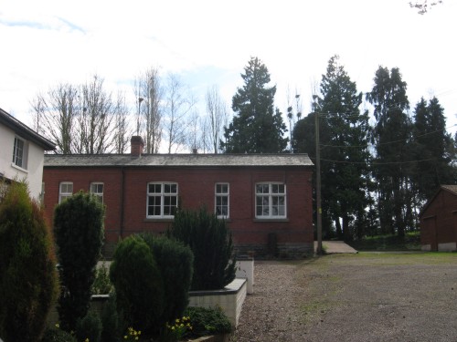
|
Dingestow station holds the
record for being the most intact of the CMUPR stations, since
it retains its building, station master's house and platform,
which all survive in a station footprint which is completely
intact. It is evidently well-looked after with someone still
living in the station house; consequently obtaining a decent
photo really requires their permission to wander around the place
and they seemed to be out on both occasions when we called, so
a photo over the gate had to suffice.
The brick building most closely
resembles Llandenny and bears little resemblance to the buildings
at Usk, Raglan and Monmouth Troy, which were built during the
20-year-long upgrade of the line. It is therefore more likely
that it is original; if so, it is probably the only CMUPR building
in decent condition.
The village is an attractive
place and produced an average of over 15 passengers per day in
peak years. Levels of business then slowly slipped (to about
6 passengers per day) and staffing levels were reduced by two-thirds
(to 1) by the 1930s. After closure the site slowly became overgrown,
but seems to have been doing well enough by the time the road
came along to justify the planners showing a spot of imagination
and finding the road its own course for a few yards to pass the
station behind the line of trees. It is not as quiet as it used
to be, but its future seems assured. |
|
Monmouth Troy
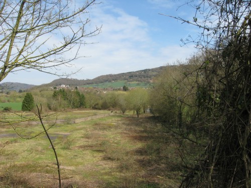
|
Monmouth Troy station, situated
in the shadow of the Gibralter Rock, marked the end of the line
for the first four years but was always intended as a through
station. Trains arrived from Usk through a short tunnel and immediately
entered the two-platform station, with the crossover into the
Usk-bound platform being situated in the tunnel. The platforms
ran in a straight line away from the camera; the goods yard was
off to the left. Its facilities were initially fairly basic,
but as its importance rose the station was developed and its
building tally increased.
An extension to Wyesham came
in 1861 - a short extension, but nonetheless expensive. The Monnow
Valley Railway began work on another tunnel off to the left in
1865, which would have carried it under the north flank of the
Gibralter Rock, around the south flank of Monmouth and up the
Monnow Valley to Pontrilas. This scheme collapsed, leaving a
short isolated tunnel which would have required new platforms
on another alignment across the goods yard were it to carry passengers.
The Ross and Monmouth Railway arrived in 1874 and was worked
with the line from Pontypool as a through route until 1923. The
Wye Valley Railway came from Chepstow in 1876; it was due to
provide a turntable for the station to allow tender engines to
frequent the lines, but that fell through. Expansion finished
with the completion of the Coleford extension by the GWR in 1883.
After the Coleford Branch
closed in 1917 the station settled down as a country junction
at the centre of three independently worked branchlines. Each
supplied four daily passenger trains and a daily freight train.
Passenger services peaked in 1954 with 19 arrivals each day.
This then dropped back to 12 for the first half of 1955, slumped
to 8 after the closure of the CMUPR and collapsed to one daily
freight (Sundays excepted) from Chepstow between 1959 and 1964.
Looking down from above the
tunnel portal now it is hard to believe the bustle that could
once have centred on the station at peak times. It was used as
a lorry base and coal distribution centre for about two decades
after closure. The footbridge between the two platforms was removed
in July 1957; the buffet and the shelter on the second platform
were removed after total closure in 1964. The main building was
removed to Winchcombe station on the Gloucestershire & Warwickshire
Railway in 1986. The goods shed was demolished in 2001. The goods
yard is now a housing estate, but the platform area, linking
the bridges at the west end with the blocked-up tunnel portal
at the east, remains clear. The station is still the epitome
of the rural country station - quiet, attractively sited and
closed, though perchance not forever. |
|
Wyesham Wharf
|
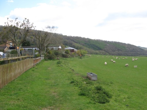
Wyesham Wharf was at the eastern
end of the 1862 extension of the line, most of which was located
on a highly expensive viaduct. The wharf was a standard transhippment
wharf with the tramway from Coleford to Monmouth May Hill up
on the platform and the CMUPR providing a few sidings alongside.
When the Wye Valley Railway
arrived in 1876 it created an end-on junction with the older
railway and the line over the viaduct was given the necessary
overhaul to allow it to carry passenger trains. The wharf fell
into disuse and disappeared when the Coleford Branch was built. Thus
in 1883 the site became a proper junction, although the actual
junction proper was at the far end of the layout.
The WVR passed into Great
Western control in 1905, bringing all rails at the junction under
a common owner. Junction status was lost when the Coleford Branch
closed in 1917, but some importance was regained when a halt
was built behind the camera in 1931. Passenger services ceased
in 1959, with snowballs being thrown at the final special train
on the 4th of January; the last train was a goods working from
Monmouth Troy five years and two days later.
Now Wyesham holds the record
of being the only place on the WVR to build significantly on
its railway past; the trackbed runs between the fence on the
left and the thin strip of rough ground towards the right to
vanish under the houses in the distance. Happily there is plenty
of room around the back for a new formation to veer around the
obstruction. |
Reopening possibilities are
dealt with above; for some reason a spur to Usk has never been
considered at the same length as Wye Valley regeneration. The
disappearance of much of the trackbed and the lack of a suitable
inspiration point (the refurbished Tintern station probably has
a lot to answer for) will be factors in this. Reinstating the
line to Usk also doesn't have the same "big bang" quality
as a large-scale expensive link overcoming the odds to run trains
through Tidenham Tunnel again either. Usk would undoubtably benefit
from the link and it would put Raglan within a reasonable
walking distance of the rail network (and within a comfortable
cycling distance), showing the ability of short rail spurs to
pierce potential tourist areas and widen the area accessible
to those from further afield without a car.
But if the WVR is deemed to
be little-known then that almost leaves no category to put this
railway in. Which may be why the main page for this part of the
website is headed with "The Wye Valley Railway" rather
than "The Coleford, Monmouth, Usk and Pontypool Railway".
That and the fact that the latter is just too long-winded to
head an internationally-read webpage. "The Trothy Valley
Railway" would have been so much snappier; sadly the very
briefly proposed cut-off from Abergavenny to Raglan, which would
have followed the Trothy for a little longer, was never built.
|
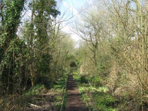
The background image on this
page shows the line from the overbridge on the east side of Usk,
looking back down the nature reserve towards Usk Tunnel and the
former station. |
More information and "past"
photos can be found in Branch
Lines to Monmouth (Vic Mitchell and Keith Smith, Middleton
Press, 2008) and The Ross, Monmouth and Pontypool Road Line
(Stanley C. Jenkins, Oakwood Press, 2002, 2009). The
National Archives hold the GWR survey of the line under RAIL
274/56
<<<Wye
Valley Railway<<<
>>>Forest
of Dean Central Railway>>>
>>>Ross
and Monmouth Railway>>>
>>>Coleford
Branch>>>
<<<Railways
Department<<< |